Google
worth noting
Tools and apps
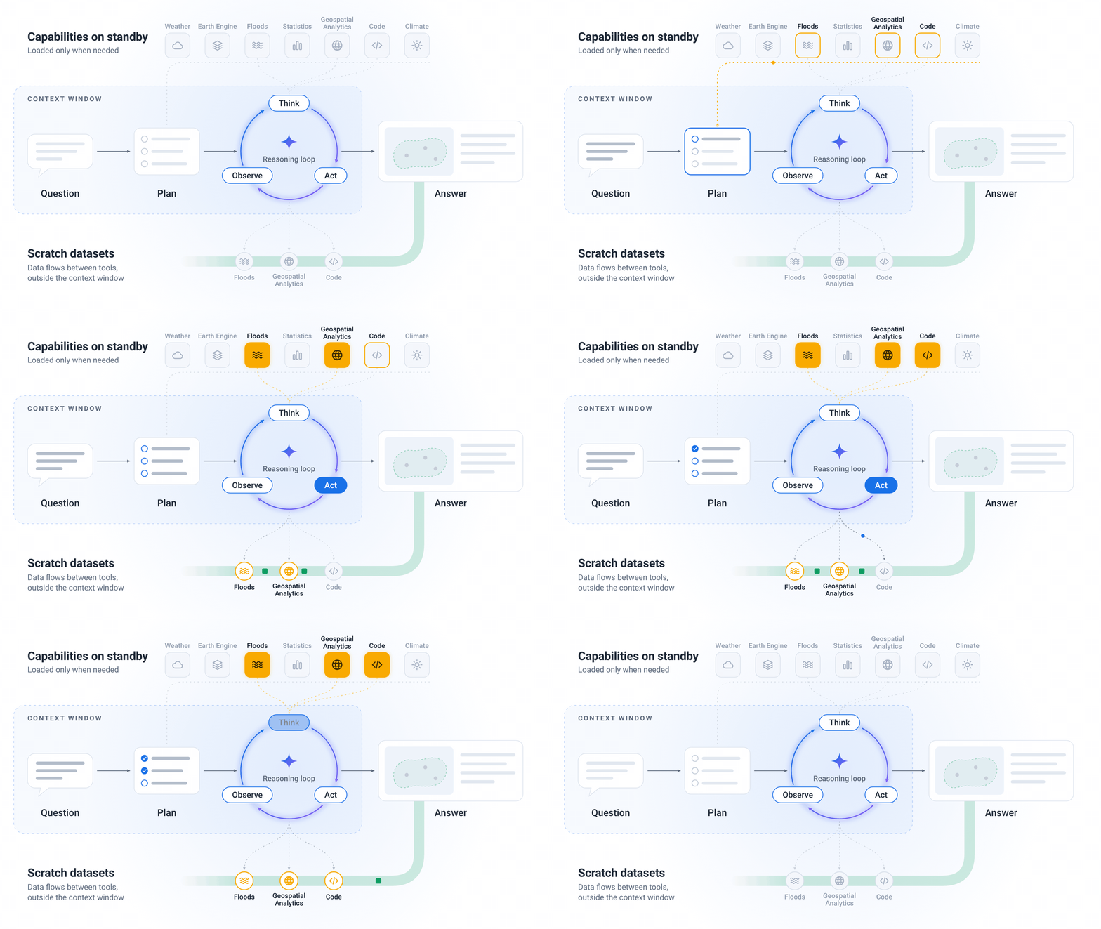
Google expands experimental access to the Geospatial Reasoning agent and adds analysis of users’ own data
Google is expanding early access to the Geospatial Reasoning agent through the Ask Google Earth service and the A2A interface. The API allows users to add their own data in CSV and GeoJSON formats or from cloud tables and combine it with geospatial models and catalogs.
What you get out of it
An analyst with early access can review the data used and the analytical plan behind a response to assess the assumptions underlying a particular result.
1 source
Details and sources →